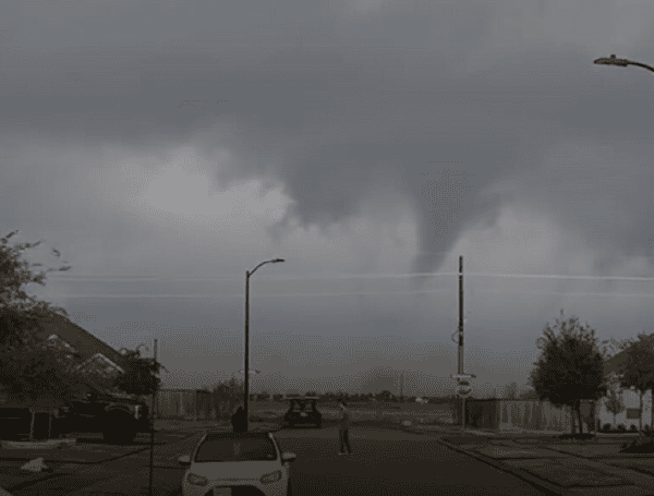
Millions of residents from the southern Plains through the Midwest faced a significant threat of severe weather on Easter Sunday, April 20, 2025, just one day after deadly flooding and intense thunderstorms battered parts of Texas and Oklahoma.
The dangerous conditions on Saturday claimed at least two lives in Moore, Oklahoma, including a 12-year-old boy, after their vehicle was swept away by floodwaters.
Meanwhile, several reports of possible tornadoes emerged from areas in Texas. A video captured near Hico, Texas, showed a confirmed tornado touching down on Saturday, April 19.
READ: Lithium-Ion Battery Fire Displaces Wimauma Family
As the powerful weather system continued its eastward trek, a Tornado Watch was issued on Sunday, encompassing portions of Kansas, Oklahoma, Texas, Louisiana, Arkansas, and Missouri. This watch, in effect until 7 p.m. CT, covers a vast area impacting more than 5 million people in major cities such as Joplin, Springfield, and Columbia in Missouri; Fayetteville, Fort Smith, and Little Rock in Arkansas; and Shreveport in Louisiana.
The severe weather potential ramped up throughout Sunday as a potent upper-level storm system moved from the Texas Panhandle into the Midwest. A rapidly strengthening low-pressure center is pulling in warm, humid air, providing ample fuel for thunderstorms. Daytime heating further destabilized the atmosphere, allowing storms to intensify rapidly.
Forecasters warned of multiple rounds of severe weather throughout Sunday, packing threats including damaging winds, large hail, tornadoes – potentially some strong – and the risk of significant flash flooding.
READ: China Is Making Nice With World After Trump Dishes Out Tariff Beating
AccuWeather meteorologists highlighted a “high risk” zone for severe weather on Sunday, specifically from Arkansas through the Missouri Valley, including much of central Missouri. While a few tornadoes are likely, the greatest threat is expected to be widespread damaging straight-line wind gusts potentially exceeding 70 mph as storms consolidate into a fast-moving squall line.
The timing of the severe weather coincides with a busy holiday weekend, increasing the importance of staying informed. AccuWeather Senior Director of Forecasting Operations Dan DePodwin noted that areas hit hard by severe weather in early April could face impacts yet again, leading to potential disruptions in travel, business, supply chains, and shipping across the region.
Earlier on Sunday, severe weather triggered tornado sirens in Camdenton, Missouri, where a video shared from the area appeared to show a funnel cloud attempting to form during a tornado-warned storm.
READ: Russia Declares Easter Truce, But Kyiv Says Attacks Haven’t Stopped
The severe threat is expected to diminish somewhat as the storms move eastward into the Ohio and Tennessee valleys and towards the central Gulf Coast on Monday morning, though scattered strong storms with hail and gusty winds remain possible.
Looking ahead, forecasters anticipate additional rounds of showers and thunderstorms across the central U.S. later in the week. This pattern offers welcome drought relief for parts of the High Plains but poses a renewed flood risk for areas already saturated by recent rains.
Residents across the affected regions are urged to monitor local weather alerts and have a plan in place to seek shelter if severe weather threatens.
Please make a small donation to the Tampa Free Press to help sustain independent journalism. Your contribution enables us to continue delivering high-quality, local, and national news coverage.
Connect with us: Follow the Tampa Free Press on Facebook and Twitter for breaking news and updates.
Sign up: Subscribe to our free newsletter for a curated selection of top stories delivered straight to your inbox.

