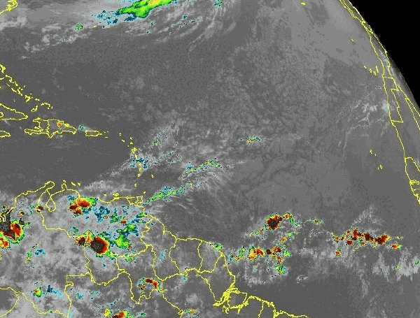
Cuba is bracing for a significant increase in rainfall and thunderstorms this week as the first tropical wave of the 2025 Atlantic hurricane season tracks westward through the Caribbean Sea, south of the island.
According to the latest Tropical Weather Discussion from the National Hurricane Center (NHC), an eastern Caribbean tropical wave is currently located near 70W longitude, extending south from the Dominican Republic towards northwestern Venezuela. The system is progressing westward at a steady pace of approximately 17mph.
NHC forecasters have already reported scattered showers and isolated thunderstorms associated with this wave, particularly near the Mona Passage and over parts of northern Venezuela. As the wave continues its westward trajectory, it is expected to move across the central Caribbean through late Tuesday and into the southwest Caribbean by midweek.
READ: Powering Through Peril In Florida: Essential Generator Safety As Hurricane Season Looms
This path will bring the tropical wave south of Cuba, leading to an anticipated surge in wet weather across the country. Residents can expect periods of heavy rain and an increased likelihood of thunderstorms, which could potentially lead to localized flooding in vulnerable areas.
While this system is currently a tropical wave and not a named storm, such waves are common precursors to tropical development, especially as the hurricane season officially begins on June 1st. Authorities typically advise residents in areas prone to heavy rainfall to stay updated on local weather advisories and take necessary precautions.
READ: NOAA’s Warning To Florida: Above-Average Hurricane Season Looms For 2025
Meteorologists are also monitoring a central Atlantic tropical wave further east, near 44W, though it is not an immediate concern for the Caribbean. Another tropical wave is forecast to enter the eastern Caribbean basin by Thursday morning, indicating an active start to the tropical weather pattern in the region.
Elsewhere, the Gulf of Mexico is experiencing hazy conditions due to agricultural fires in southeastern Mexico, affecting visibilities. A surface ridge is currently dominating the Gulf, but a weak cold front is expected to move into the northern Gulf by Friday morning. The broader Atlantic Ocean sees a subtropical ridge influencing weather patterns, with moderate to fresh winds south of 25N.
Please make a small donation to the Tampa Free Press to help sustain independent journalism. Your contribution enables us to continue delivering high-quality, local, and national news coverage.
Connect with us: Follow the Tampa Free Press on Facebook and Twitter for breaking news and updates.
Sign up: Subscribe to our free newsletter for a curated selection of top stories delivered straight to your inbox.

