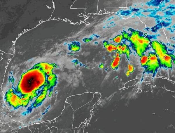
The National Oceanic and Atmospheric Administration (NOAA) has released its outlook for the 2025 Atlantic hurricane season, predicting a strong likelihood of an above-normal level of activity. The season, which officially runs from June 1st to November 30th, is forecast to have a 60% chance of being above normal, a 30% chance of being near normal, and only a 10% chance of being below normal.
NOAA anticipates a range of 13 to 19 total named storms, which include tropical storms with winds of 39 mph or higher. Of these, 6 to 10 are expected to strengthen into hurricanes, boasting winds of 74 mph or higher. The outlook also predicts the potential for 3 to 5 major hurricanes, classified as Category 3, 4, or 5 storms with wind speeds reaching 111 mph or greater. NOAA expresses a 70% confidence in these projected ranges.
READ: Colorado State University Researchers Forecast Above-Average 2025 Atlantic Hurricane Season
“NOAA and the National Weather Service are using the most advanced weather models and cutting-edge hurricane tracking systems to provide Americans with real-time storm forecasts and warnings,” stated Commerce Secretary Howard Lutnick. “With these models and forecasting tools, we have never been more prepared for hurricane season.”
Acting NOAA Administrator Laura Grimm emphasized the far-reaching impacts of these powerful storms, recalling last year’s significant inland flooding from hurricanes Helene and Debby. “As we witnessed last year with significant inland flooding from hurricanes Helene and Debby, the impacts of hurricanes can reach far beyond coastal communities,” said Grimm. “NOAA is critical for the delivery of early and accurate forecasts and warnings, and provides the scientific expertise needed to save lives and property.”
Several key factors are contributing to the expectation of an above-normal season. These include the continuation of ENSO-neutral conditions, warmer-than-average ocean temperatures across the Atlantic, forecasts indicating weak wind shear, and the possibility of heightened activity from the West African Monsoon, a region where many Atlantic hurricanes originate. These conditions are generally conducive to tropical storm development.
READ: Powering Through Peril In Florida: Essential Generator Safety As Hurricane Season Looms
The Atlantic Basin remains in a high-activity era, characterized by high ocean heat content and reduced trade winds. The increased heat provides more energy to fuel storm intensification, while weaker winds allow developing storms to organize and strengthen without disruption. Additionally, there is a potential for a northward shift in the West African monsoon, which could lead to the formation of tropical waves that can evolve into significant Atlantic hurricanes.
NOAA’s National Weather Service Director Ken Graham urged residents to take the outlook seriously. “In my 30 years at the National Weather Service, we’ve never had more advanced models and warning systems in place to monitor the weather,” said Graham. “This outlook is a call to action: be prepared. Take proactive steps now to make a plan and gather supplies to ensure you’re ready before a storm threatens.”
Looking ahead to the 2025 season, NOAA is committed to enhancing its hurricane analysis and forecasting capabilities. Key improvements include an upgrade to NOAA’s Hurricane Analysis and Forecast System, which is expected to yield a further 5% improvement in tracking and intensity forecasts. The National Hurricane Center (NHC) and Central Pacific Hurricane Center will also be able to issue tropical cyclone advisory products up to 72 hours before the anticipated arrival of storm surge or tropical-storm-force winds on land, providing communities with more valuable preparation time. Furthermore, NOAA’s Climate Prediction Center’s Global Tropical Hazards Outlook will be extended from two to three weeks, offering an extended window for early awareness of potential tropical cyclone risks.
For the upcoming season, the NHC will offer Spanish language text products for crucial information, including the Tropical Weather Outlook, Public Advisories, and Tropical Cyclone Discussions. The experimental forecast cone graphic will again be issued, this year highlighting areas under both a hurricane watch and a tropical storm warning simultaneously. Additionally, a rip current risk map will be provided by the NHC when an active tropical system is present, utilizing data from local National Weather Service forecast offices to warn of dangerous coastal conditions.
NOAA is also deploying innovative tools this year, including ROARS, an experimental electronically scanning radar system on NOAA’s P-3 hurricane hunter research aircraft, to gather data on ocean waves and hurricane wind structure. The Weather Prediction Center’s experimental Probabilistic Precipitation Portal will offer user-friendly access to rain and flash flood forecasts up to three days in advance, a critical tool highlighted by the significant inland rainfall experienced during Hurricane Helene in 2024.
It is important to note that NOAA’s outlook provides an overall seasonal forecast and does not predict specific landfalls. NOAA has also issued hurricane outlooks for the eastern and central Pacific basins. The Climate Prediction Center is scheduled to update the 2025 Atlantic seasonal outlook in early August, prior to the historical peak of the hurricane season. Residents of Wesley Chapel and all coastal and inland communities are strongly encouraged to prepare now for the potential impacts of an active hurricane season.
Please make a small donation to the Tampa Free Press to help sustain independent journalism. Your contribution enables us to continue delivering high-quality, local, and national news coverage.
Connect with us: Follow the Tampa Free Press on Facebook and Twitter for breaking news and updates.
Sign up: Subscribe to our free newsletter for a curated selection of top stories delivered straight to your inbox.

