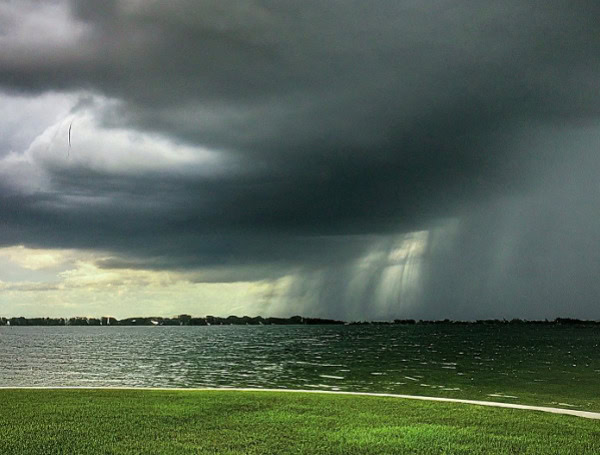
While no major widespread severe weather outbreaks are on the horizon, multiple regions across the United States are bracing for potent, locally dangerous, and damaging thunderstorms that are expected to persist through at least Mother’s Day, according to AccuWeather meteorologists.
The immediate threat, extending into Thursday night, targets a significant zone from central Mississippi northeastward across large portions of West Virginia and Virginia. This area, which includes communities still recovering from last hurricane season’s Hurricane Helene, faces primary dangers from high wind gusts, significant hail, and flash flooding, particularly in urban areas and along small streams.
READ :FBI Opens Formal Investigation Into Letitia James Over Mortgage Fraud Allegations
“The main threat to lives and property from these storms will be high wind gusts, significant hail and flash flooding,” stated Alex Sosnowski, AccuWeather senior meteorologist. He emphasized that most of these thunderstorms will be most active from midafternoon to midevening. Airline passengers should anticipate significant delays at major hubs such as Atlanta and Charlotte, with cascading effects likely for regional connecting flights through Thursday evening.
Further southwest, a more intense zone of thunderstorms is forecast to impact the Rio Grande Valley of Texas and Mexico into Thursday evening. “The storms in this sector will have the potential to produce powerful wind gusts by way of large, destructive downbursts,” warned AccuWeather Meteorologist Brandon Buckingham. He added, “Where the storms repeat, there can be dangerous flash flooding as well.” Some of the strongest cells in this region could also produce large hail and potentially a few tornadoes.
The danger of lightning strikes, which can occur with little warning, remains a significant concern. The National Lightning Safety Council has already reported two lightning-related fatalities in the U.S. in 2025. Powerful wind gusts also pose risks by breaking tree limbs and potentially causing power surges and extended outages.
READ: Pennsylvania Sen. Fetterman Slams Unfitness Allegations As “One Source Hit Piece”
However, according to Accuweather, the severe weather threat is expected to diminish over South Texas by Friday. The likelihood of heavy, gusty thunderstorms will shift to the southern Atlantic Seaboard during the afternoon and evening. Storms capable of disruptive torrential downpours and gusty winds are anticipated from southeastern Virginia down through much of the Florida Panhandle and the northeastern part of the Florida Peninsula. A few heavy, gusty thunderstorms may also develop further west, affecting the lower Mississippi Valley, the central Gulf coast, and a small portion of the southern Plains.
Thunderstorm dangers are projected to continue through the Mother’s Day weekend. At a minimum, locally heavy and gusty thunderstorms are expected along the southern and eastern flanks of a slow-moving low-pressure area situated over the Southern states. This zone of activity might be confined to a smaller part of the southern Atlantic coast on Saturday but could expand westward and northward on Sunday.
READ: Seven-Time Convicted Brandon Felon Arrested After High-Speed Motorcycle Chase
Looking ahead to early next week, as this storm system slowly tracks northeastward, robust thunderstorms are likely to persist, potentially causing disruptions and damage in parts of the Southeastern states and the Northeast.
Simultaneously, a slow-moving storm system originating from the Pacific may begin to trigger severe thunderstorms over portions of the northern Rockies early next week. This activity could then spread to sections of the northern Plains and Upper Midwest later in the week, fueled by a clash between summerlike air and an incoming push of much cooler air.
“There certainly looks like a great deal of dynamics from the jet stream in place for the middle of next week, but moisture may be too limited for widespread severe weather,” commented AccuWeather Expert Long-Range Meteorologist Joe Lundberg. “However, if conditions change, then the scope of severe weather for the North Central states could increase.”
Please make a small donation to the Tampa Free Press to help sustain independent journalism. Your contribution enables us to continue delivering high-quality, local, and national news coverage.
Connect with us: Follow the Tampa Free Press on Facebook and Twitter for breaking news and updates.
Sign up: Subscribe to our free newsletter for a curated selection of top stories delivered straight to your inbox.

