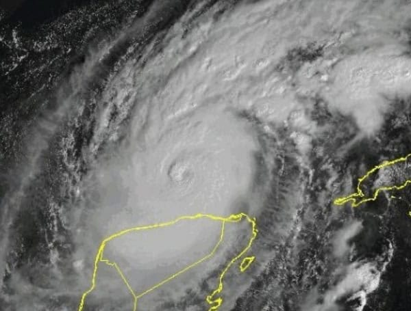
The 2025 Atlantic hurricane season officially began on Sunday, June 1st, and is poised to be another exceptionally active period, with AccuWeather meteorologists predicting a near-to-above-average number of storms, including a significant threat of “rapid intensification.”
Forecasters are expressing concern that this season could mirror the ferocity of the 2024 season, which was one of the most devastating and costly on record, characterized by “super-charged” storms like the earliest recorded Category 5 Beryl, the Southeast-pummeling Helene, and the destructive Milton across Florida.
AccuWeather Lead Hurricane Expert Alex DaSilva anticipates 13 to 18 named storms, with 7 to 10 hurricanes, and 3 to 5 major hurricanes (Category 3 or higher). Crucially, 3 to 6 direct U.S. impacts are also on the radar. DaSilva notes a 20% chance of exceeding 18 named storms.
READ: NOAA’s Warning To Florida: Above-Average Hurricane Season Looms For 2025
The overall intensity of the season, measured by Accumulated Cyclone Energy (ACE), is projected to be between 125 and 175, which is above the 30-year historical average of 123 and comparable to the high levels observed in 2024.
While an early start to the season with favorable tropical development in June is possible, a potential lull in activity could be followed by a busy end to the year, mirroring the 2024 season where 13 of 18 named storms occurred between September and mid-November. The peak of the hurricane season typically falls on September 10th.
A primary driver for this year’s heightened activity is the widespread abundance of warm water across the Atlantic basin.
“The water temperatures across most of the Atlantic are above average for this time of the year,” DaSilva stated. “They’re not quite as warm as what we saw last year and in 2023, but they’re still well, well above average.” These persistently warm waters are expected to prime storms for explosive development throughout the season.
READ: Hurricane Season Is Here: Pasco County Says “Be Prepared”
The concerning trend of “rapid intensification” is expected to be a major storyline once again.
“A rapid intensification of storms will likely be a major story yet again this year as sea-surface temperatures and ocean heat content (OHC) across most of the basin are forecast to be well above average,” DaSilva explained. OHC, which measures both water temperature and the depth of warm water, provides substantially more fuel for hurricanes.
This phenomenon was tragically highlighted in 2022 when Hurricane Ian rapidly intensified from a Category 3 to a Category 5 before making landfall in Florida, leading to catastrophic storm surge.
La Niña’s Potential Return and Landfall Risks
The ongoing dynamics in the eastern Pacific Ocean, particularly the potential return of La Niña, will also play a significant role. While neither La Niña nor El Niño is expected during the first half of the season, a shift towards La Niña by September, October, or November could lead to an active conclusion, similar to late last year.
READ: EV Owners In Florida Brace For Potentially Active Hurricane Season, Take Unique Precautions
In terms of landfall, “Similar to last year, northern and eastern portions of the Gulf Coast and the Carolinas are at a higher-than-average risk of direct impacts this season,” DaSilva elaborated. “Atlantic Canada and the northeastern Caribbean are also at an increased risk of direct impacts.”
However, forecasters emphasize that inland impacts can be just as devastating. The 2024 season served as a stark reminder, with Hurricane Beryl spinning up over 60 tornadoes across its 1,200-mile path and Hurricane Helene bringing catastrophic flash flooding and destructive winds hundreds of miles inland in western North Carolina.
AccuWeather’s long-range forecasting team utilizes analog years with similar global weather patterns to refine their predictions. The 2017 and 2023 seasons, which included notorious storms like Harvey, Irma, and Idalia, are among the recent matches.
Additional Factors to Watch
Several other factors could influence the upcoming season. The position and strength of the Bermuda-Azores high-pressure system can dictate storm tracks, potentially leading to recurving systems in the western Atlantic or storms reaching the Caribbean and Gulf.
The “Atlantic Niña” phenomenon, characterized by cooler waters off the west coast of Africa, could periodically introduce dry air and limit tropical activity, as observed last August and early September. Conversely, a warming in this region could enhance development.
READ: BBB Sounds Alarm: Floridians Urged To Prepare For “Above Average” 2025 Hurricane Season
Additionally, an increase in tropical waves originating from Africa, which are clusters of showers and thunderstorms, could lead to an uptick in named storms and hurricanes. However, massive clouds of dry, dusty air from Africa can also temporarily suppress activity.
As the Atlantic hurricane season officially commences, residents in vulnerable areas are urged to prepare for a potentially active and dangerous period.
Please make a small donation to the Tampa Free Press to help sustain independent journalism. Your contribution enables us to continue delivering high-quality, local, and national news coverage.
Connect with us: Follow the Tampa Free Press on Facebook and Twitter for breaking news and updates.
Sign up: Subscribe to our free newsletter for a curated selection of top stories delivered straight to your inbox.

