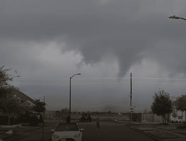
While severe thunderstorms are a familiar occurrence in the late spring months, AccuWeather meteorologists are warning of a significant escalation of severe weather this week. This could potentially culminate in a heightened risk of tornadoes across portions of the Ohio, Tennessee, and mid-Mississippi valleys by Friday afternoon and evening. This development comes during what is already being described as the worst tornado season in over a decade.
AccuWeather Senior Director of Forecasting Operations Dan DePodwin emphasized the growing concern among meteorologists. “There is increasing concern among our meteorologists that Thursday and Friday are very active severe weather days, at least in terms of damaging winds and the potential for tornadoes,” he stated.
READ: Flash Flood Emergency Declared In Western Maryland As Torrential Rains Lash Tri-State Area
Despite a recent lull in severe activity, DePodwin cautioned residents in potentially affected areas against complacency. “Even though severe thunderstorms have been relatively sparse lately, we advise people in alerted areas to not let their guard down,” he urged. “We are quickly approaching the peak of severe weather season and there will be numerous opportunities for severe thunderstorms through at least the middle of next week.”
The impending surge in severe weather is being attributed to a Pacific storm that is poised to disrupt an early-season heat wave in the northern Plains. The initial phase of this weather system is expected to bring powerful wind gusts and hail to the northern Plains and the Upper Midwest through Wednesday night, according to AccuWeather Senior Storm Warning Meteorologist Eddie Walker. Importantly, vast amounts of dry air are expected to limit the immediate threat of tornadoes in these regions.
However, the situation is forecast to change as the storm system progresses southeastward into a more moisture-rich environment. By Thursday afternoon and evening, all forms of severe weather, including high winds, hail, flash flooding, and tornadoes, will become possible. “Thursday evening will bring vigorous activity in eastern Minnesota, Wisconsin, Michigan and northern Indiana, moving east into Ohio during the overnight hours,” Walker explained.
READ: Pennsylvania Judge Greenlights Trump Deportation Tool Against Venezuelan TdA Gang
The tornado threat is expected to intensify further on Friday, with AccuWeather meteorologists raising the alert level to high for parts of the Ohio Valley. DePodwin highlighted the relationship between heat and severe weather, stating, “We always look at the edge or rim of heat, in this case record heat, for where severe thunderstorms can erupt. On Friday, the setup could trigger a swath of damaging winds and tornadoes.”
A particularly dangerous scenario may unfold across a zone stretching from the middle Mississippi Valley through much of the Ohio Valley and into part of the Tennessee Valley from Friday afternoon into Friday night. “Friday will be a moderate to high risk day for at least several tornadoes, even some of long duration,” Walker warned.
Long-duration tornadoes often possess significant strength, potentially reaching EF2 intensity or higher. Meteorologists are concerned that if the situation reaches its full potential, multiple strong, long-track tornadoes could touch down, with some possibly lasting beyond nightfall.
READ: Florida Red Tide Update: Organism Detected At Background Levels In Isolated Gulf Coast Samples
The severe weather threat is predicted to expand eastward into the mid-Atlantic region during Friday night.
Walker noted that “On Saturday, additional development of severe thunderstorms will occur along a cold front draped from the southern Plains, eastward to the Carolinas.” This could bring a risk of severe thunderstorms to the Interstate 95 mid-Atlantic region for part of the day.
Looking ahead, Walker added, “Then the severe weather may reset back into the central Plains states on Sunday.” Forecasts indicate the potential for another outbreak of severe weather, including the risk of tornadoes, to develop over the Plains and gradually move eastward next week.
Please make a small donation to the Tampa Free Press to help sustain independent journalism. Your contribution enables us to continue delivering high-quality, local, and national news coverage.
Connect with us: Follow the Tampa Free Press on Facebook and Twitter for breaking news and updates.
Sign up: Subscribe to our free newsletter for a curated selection of top stories delivered straight to your inbox.

