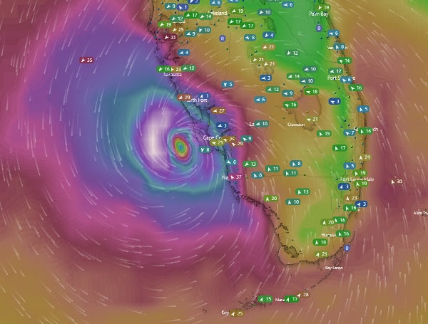
As Hurricane Ian’s eyewall approaches land and the threat for extreme wind is expected inland, the National Weather Service will issue an Extreme Wind Warning (EWW).
The EWW product is a text product produced by National Weather Service (NWS) offices.
The following criteria is used for the issuance of extreme wind warnings, according to NWS.
- Imminent onset of, or occurring, tropical cyclone-related sustained surface winds, greater than or equal to 100 knots (115 mph).
- Extreme tropical cyclone winds are expected to occur within a WFO’s county warning area within an hour.
In addition, Extreme Wind Warnings will:
- Be issued for the smallest geographic area possible, encompassing the extreme wind conditions and use valid times of two hours or less.
- Not be reissued for the same location (if conditions persist, we will follow-up information or updates will be provided within Severe Weather Statements).
The EWW will alarm the wireless emergency alert (WEA) and NOAA Weather Radio and provide people with a heightened, short-fused warning of impending wind of 115 mph or greater.
“The last time we issued the EWW from this office was for Hurricane Irma in September 2017,” said the NWS.
Visit Tampafp.com for Politics, Sports, and National Headlines. Support journalism by clicking here to our GiveSendGo or sign up for our free newsletter by clicking here.
Android Users, Click Here To Download The Free Press App And Never Miss A Story. Follow Us On Facebook Here Or Twitter Here.
Copyright 2022 The Free Press, LLC, tampafp.com. All rights reserved. This material may not be published, broadcast, rewritten, or redistributed.


