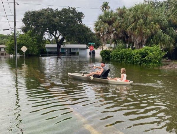
The upcoming 2024 Atlantic hurricane season is shaping up to be one of the most active and potentially destructive on record.
The National Oceanic and Atmospheric Administration (NOAA), the leading authority on weather and climate, has issued a dire forecast, predicting an 85% chance of an above-normal season with a range of 17 to 25 total named storms.
The confluence of several key climate patterns and oceanic conditions is setting the stage for a particularly active 2024 Atlantic hurricane season.
Read: NHC Monitoring Tropical Wave Ahead Of Florida Hurricane Season Start
Foremost among these is the development of La Niña conditions in the Pacific Ocean, which tend to suppress wind shear and create more favorable environments for tropical storm formation in the Atlantic basin.
Additionally, record-warm ocean temperatures in the tropical Atlantic and Caribbean Sea are providing an abundant source of energy to fuel storm intensification.
La Niña, the counterpart to the better-known El Niño, is a periodic cooling of the equatorial Pacific Ocean that can have far-reaching implications for global weather patterns.
During a La Niña event, the Atlantic typically experiences reduced wind shear, a crucial factor that can inhibit or disrupt the development of tropical cyclones. This reduced wind shear, combined with warmer ocean temperatures, creates an environment that is highly conducive to hurricane formation and intensification.
The Atlantic Ocean has been experiencing a prolonged period of above-average temperatures. This oceanic warmth serves as a potent fuel source for tropical systems, allowing them to rapidly strengthen and maintain their intensity as they move across the basin.
Read: ‘Ingredients Are There’ For Busy Storm Season
The combination of La Niña and this ocean heat content represents a concerning synergy that is poised to drive an extremely active 2024 hurricane season.
In addition to the La Niña pattern and warm ocean temperatures, several other factors are aligning to create a perfect storm for heightened tropical activity.
These include reduced Atlantic trade winds, which can inhibit the natural cooling of the ocean surface, and the potential for an above-normal West African monsoon, which can generate the powerful easterly waves that often seed some of the strongest and longest-lived Atlantic hurricanes.
“With another active hurricane season approaching, NOAA’s commitment to keeping every American informed with life-saving information is unwavering,” said NOAA Administrator Rick Spinrad, Ph.D. “AI-enabled language translations and a new depiction of inland wind threats in the forecast cone are just two examples of the proactive steps our agency is taking to meet our mission of saving lives and protecting property.”
Read: Hurricane Ian Insured Losses In Florida Near $21.4 Billion
“Severe weather and emergencies can happen at any moment, which is why individuals and communities need to be prepared today,” said FEMA Deputy Administrator Erik A. Hooks. “Already, we are seeing storms move across the country that can bring additional hazards like tornadoes, flooding and hail. Taking a proactive approach to our increasingly challenging climate landscape today can make a difference in how people can recover tomorrow.”
Recognizing the imminent threat posed by the looming 2024 hurricane season, NOAA has been proactively investing in a suite of technological and operational advancements to enhance its forecasting capabilities and communication strategies.
These innovations aim to provide the public, emergency managers, and decision-makers with more accurate, timely, and accessible information to better prepare and respond to these extreme weather events.
Help support the Tampa Free Press by making any small donation by clicking here.
Android Users, Click To Download The Tampa Free Press App And Never Miss A Story. Follow Us On Facebook and Twitter. Sign up for our free newsletter.

